Snow cover duration, peak snow accumulations, snowmelt timing and snowmelt rates are some of the factors associated with the water cycle in mountain environments, with strong ecological and socio-economical impacts, not only in Switzerland, but in other mountain environments across the globe. Currently, we are performing research in these areas combining terrestrial laser scanning (TLS, see Figure 3), in-situ energy balance stations, wireless sensor networks, and other instrumentation. The overarching objective of this research is to better understand the dominant processes controlling the spatial features of snow accumulation and melt in alpine environments in the Swiss Alps.
Our efforts are concentrated in Val Ferret, located in the Swiss canton of Valais. The watershed is an alpine valley draining into the Dranse de Ferret, the Dranse, and eventually the Rhone. A map with the localisation of the meteorological stations, cameras and gauging stations is shown on Figure 2.
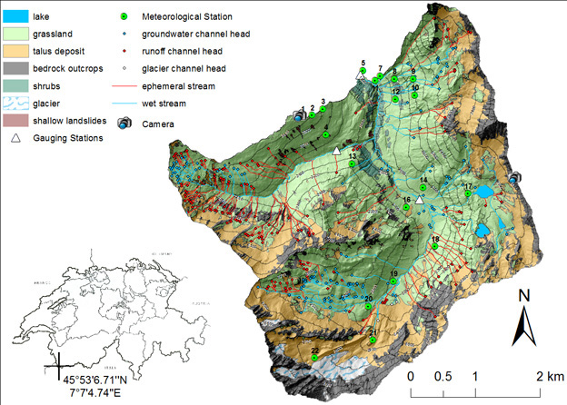
Streamflow measurements are performed for a drainage area of around 20 km2, with an elevation range between 1775 m and 3206 m, and with a mean elevation of 2423 m. The slopes are moderate to steep (mean 31.6 degrees, maximum 88.9 degrees) and vegetation is mainly grassland with some patches of firs and larch at lower elevations. The spring and summer hydrologic cycle has been the topic of extensive research in the Environmental Fluid Mechanics Laboratory of EPFL (EFLUM).
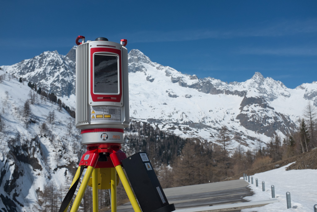
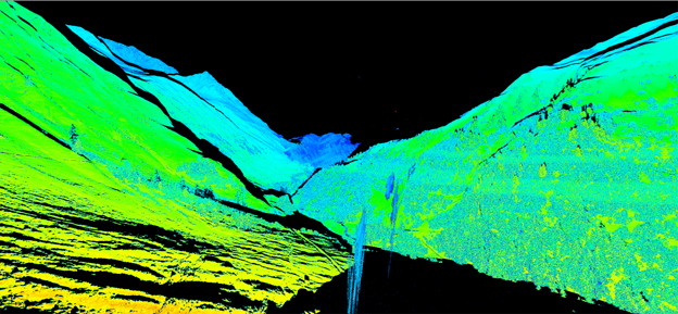
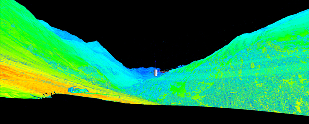
Terrestrial Laser Scanning is being performed to assess the spatial distribution of snowmelt in portions of the catchment (see Figure 3). By performing repeated laser scans of the snow covered topography, the difference in surface elevations can be used to determine the change in snow depth at very high horizontal and vertical resolutions (of the order of centimeters to tens of centimeters). From this, mass changes can be estimated and analyzed to study differential melting patterns, together with the processes affecting them. This information is useful to better understand the processes driving the melting, improve modeling strategies at such spatial resolutions, and compare model results to the observations of this differential melt. Sample laser scans in the basin is shown in the Figure 4.
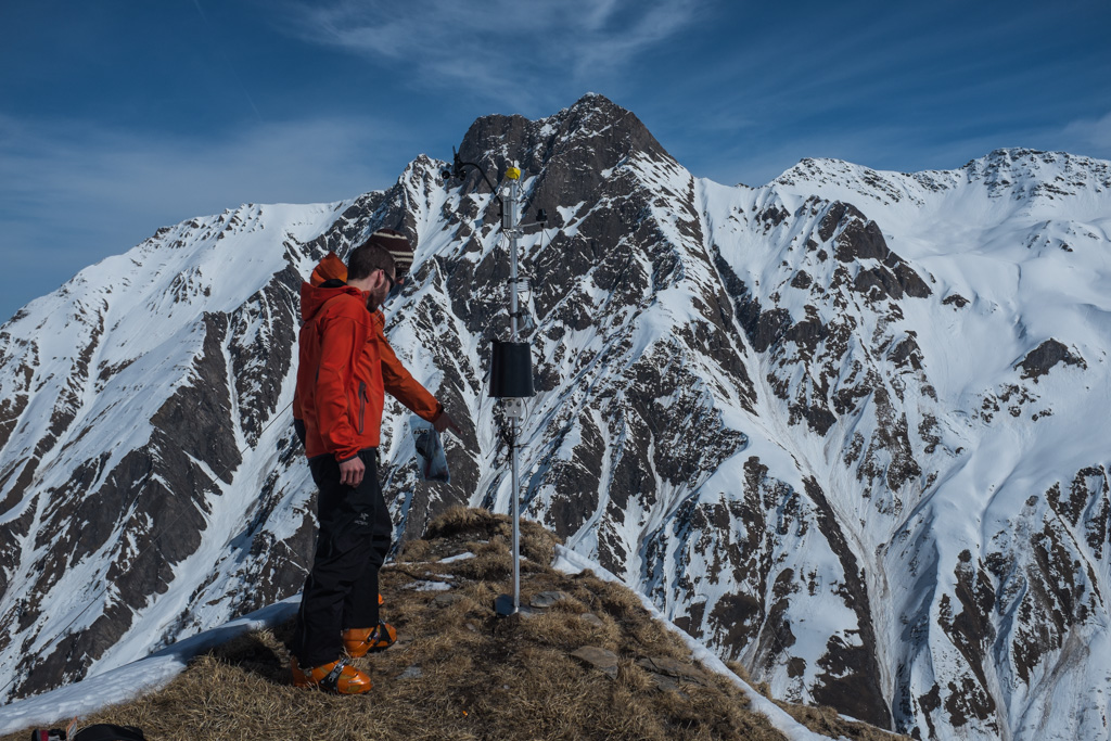
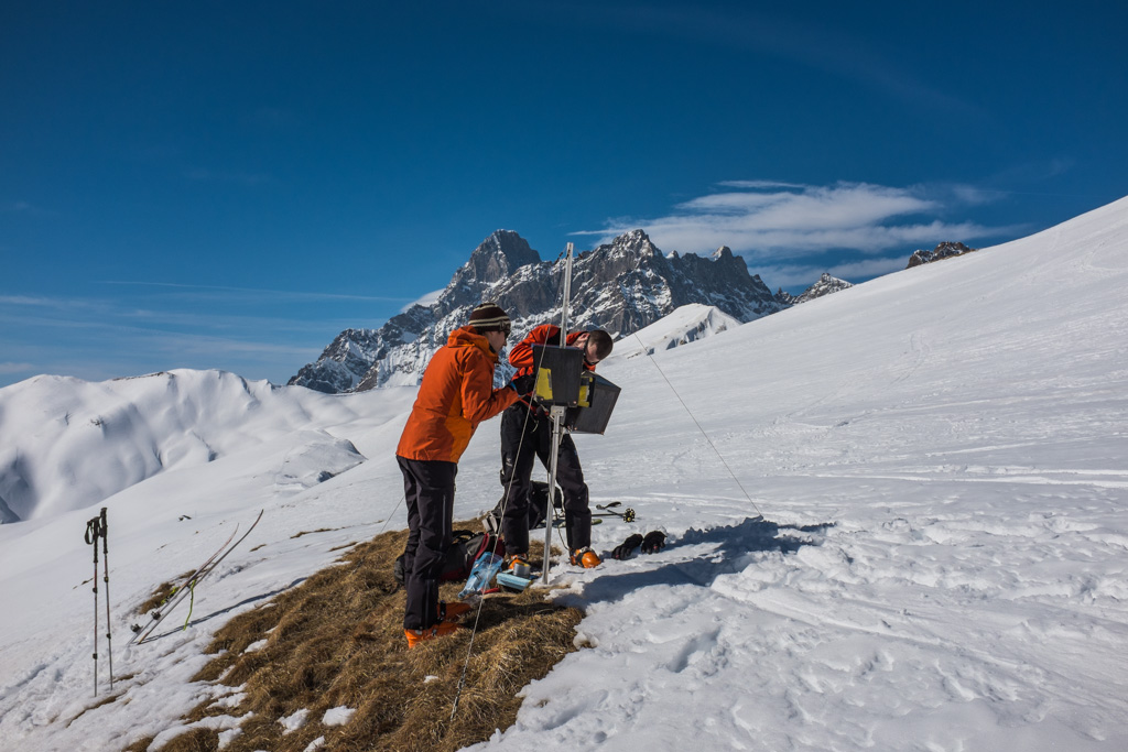
Additional data is being obtained from meteorological stations distributed along the basin.
(see Figure 5). These meteorological stations are part of an autonomous, self-organizing, multi-hop wireless sensor network (link to Sensorscope here) and stations include sensors to measure solar radiation, wind speed and direction, air and surface temperature, humidity, soil moisture and temperature, matrix potential, and precipitation
These datasets are complemented with a series of autonomous, low power time lapse photography cameras located at high points in the watershed (see Figure 6).
The projection of these image data onto the topographic surface and color-based classification between snow and non-snow surfaces allows us to determine the development of bare ground areas as snowmelt progresses. This is not only important for snow mass balance estimation, but also for albedo change and energy dynamics that are important for hydrological purposes.
Ultimately, these datasets are allowing us to develop a better understanding of snowmelt processes in alpine environments, focusing on the influence of geomorphological and climatological characteristics of the watershed (e.g., elevation, slope, aspect, solar radiation, temperature) on the spatial and temporal patterns of snowmelt.
Stream thermodynamics (temperatures) are significantly affected by climate change with drastic consequences for the aquatic fauna, ecosystems and industry. In the framework of the National Center for Climate Services (NCCS), a large-scale national research project “Hydrological Principles of Climate Change – Hydro-CH2018” composed of numerous individual studies, investigates the future hydrological situation, as well as applicable and effective mitigation and adaptation strategies. CRYOS is investigating and modeling stream temperatures in Switzerland using a unique model chain of the snow cover models Snowpack (Bartelt & Lehning, 2002) and Alpine3D (Lehning et al. 2006) as well as the hydrological model StreamFlow (Gallice et al., 2016). In a first step, this project analyzed the historical evolution of stream temperature in Switzerland (Michel et al. 2020). Current research, using the CH2018 climate change scenarios of MeteoSwiss, simulates stream temperature in Switzerland until the end of the 21st century applying low and high emission scenarios (RCP2.6 and RCP8.5). Results indicate a further rapid rise in stream temperature, increasingly often passing critical (ecological and legal) limits for water temperature in Swiss rivers. This project is funded by the Federal Office for the Environment (FOEN).